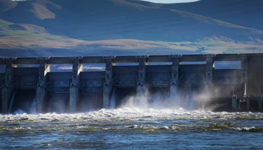
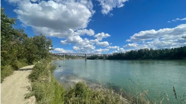
The Northwest Territories Power Corporation has been using more than seven times the usual amount of diesel to generate electricity in the North Slave as low water levels impede its hydroelectric dam system. The Snare hydro system is a series of four hydro plants that provide power to Yellowknife, Behchokǫ̀ and Dettah. The system usually generates about 98 per cent of all the electricity needed to power those communities, but this year — it's been a different story.
Money, power and an ecosystem are all at stake in Canada-U.S. negotiations over a massive river
Walk along the banks of the Columbia River in B.C. and you might be forgiven for thinking it's like any of the province's other big waterways. You might spot a sturgeon, or glimpse one of the more than 60 dams in the Columbia's watershed. But the Columbia is not like other rivers. For one, it crosses the U.S. border to empty into the Pacific in Oregon. The Columbia River basin is also a vital source of electricity, providing about 40 per cent of all U.S. hydroelectric power, while B.C. draws almost half of its total electrical generation from the region.
Surrey to remove derelict boats on Nicomekl River
Surrey city staff will begin removing derelict boats on the Nicomekl River in South Surrey, with help from Transport Canada. Derelict boats have been illegally mooring on a narrow section of the river and have been dumping raw sewage and garbage into the water, according to a city news release Wednesday. Surrey Mayor Brenda Locke says the river has many spots where boats can legally drop anchor, so there is no reason for any boater to illegally moor their vessel.
Water quality research helps bring healing and sovereignty to the Apsáalooke
When I was 8 years old, a bilingual afterschool program took me on a trip that left memories I still carry. A boat drove us into the deep canyons of Iisaxpúatahcheewilichke, Bighorn Lake. As we cruised by cliffs incised by Iisaxpúatahcheeaashe, the Bighorn River, we witnessed the power that it held: cliff sides looked as if a knife made a clean cut through a cake, except it was through sedimentary, metamorphic and igneous layers of the Earth. I will hold this day with me forever because me, my twin sister and other Apsáalooke/Crow youth saw where Uuwaatisaash was pushed off the cliffs, and where Iisaxpúatahchee Sahpua had saved him.
Waterfalls now 'trickling': Low water brings changes to Hay River, N.W.T. Social Sharing
Water levels have been significantly dropping in Hay River, N.W.T., resulting in waterfalls turning into trickles. One man has lived in Hay River for 40 years, and says he's never seen water levels so low this time of year. "You can see people walking across the river that's only a few feet deep in some areas," said Glenn Smith, the senior administrative officer for the town of Hay River.
5 things you need to know this morning: July 6, 2023
Authorities in a Western Japan city are investigating to determine how the water of a river that runs through the town has turned lime green. It’s caused great concern among citizens, but officials have run a test on the water and said it’s non-toxic. However, farmers have still been asked to avoid using it for agricultural purposes until safety is confirmed.
Ontario bans 'floating homes' from overnight stays on lakes
The province's ban will prohibit the floating homes from staying overnight on public waterways. The restrictions will take effect on July 1, according to a regulation posted by the Ministry of Natural Resources and Forestry. The ban will only apply to what the province calls "floating accommodations," defined in the regulation as floating structures designed primarily for residential purposes and not primarily for navigation. Sailboats, houseboats, cabin cruisers or other traditional watercraft are not prohibited from overnight stays.
Part of this centuries-old Quebec farm has been swallowed, maybe permanently, by the river
It took Claude Méthot a couple of days to fully comprehend the extent of the damage to his farm in Baie-Saint-Paul, Que. He says the land that he bought three years ago has been cultivated for hundreds of years. The fields that had been ready for another season of wheat, corn or oats are now covered with sand and clay. "We will not be able to farm this field anymore," said Méthot. He figures he's lost about 10 per cent of his land. "It's a primal, visceral fear and shock just to see where there was this gorgeous wheat field last year. Now it's a river."
1 home destroyed as flood risk prompts more evacuation orders in Cache Creek, B.C.: fire chief
Flooding in B.C.'s Interior has destroyed one home and forced several others to be evacuated, according to the local fire chief. Evacuation orders are now in place for five properties — including the local firehall — in the Village of Cache Creek, B.C., where a local state of emergency was declared on May 1 as the nearby creek and river threatened homes in the area and posed an "imminent threat to people and property."
Niagara-on-the-Lake gets Ds and Fs for water quality in annual Watershed Report Card
If you bring home a report card with grades like D, C-, B, and in some spots D and F you know you would have some explaining to do. The Niagara Peninsula Conservation Authority (NPCA) recently released the 2023 Watershed Report Card, a checkup on the health of the Niagara Peninsula watershed, focusing on surface and groundwater quality, forest conditions, and watershed features.
Philadelphia monitoring drinking water after chemical plant spill
Philadelphia officials say the city's water is safe to drink for now after a chemical spill in a local river. A pipe ruptured on Friday at chemical plant Trinseo PLC, leaking hazardous material into a tributary of the Delaware River, a source of water for millions of people. Officials asked people to drink bottled water, leading to empty shelves. But local authorities said later on Sunday there had been no contamination in the city's water system.
How the health of a river is influenced by what's happening on land
For some residents of northern Alberta and Saskatchewan, the North Saskatchewan River is nothing more than a flowing body of water that starts at the Saskatchewan Glacier in Banff National Park and winds its way northeast. But it's much more than that. The river is a part of a bigger network of streams and channels that feed into it on its path through the Prairies. We're talking about a watershed — an area of land that drains into a water body.
Richmond recycling company ordered to stop discharging water into river
A Mitchell Island metal and used car recycling company requested the right to continue flushing contaminated water into the Fraser River, while it appeals an earlier order to stop the practice. The request was denied. The Environmental Appeal Board, a provincial body that hears appeals of such orders, said it is in the public interest to keep the order for Richmond Steel Recycling (RSR) in place to protect the environment.
Why some people are taking a wintry dip from the banks of the Bow River
It's an uncommon sight to see in January. A group of nearly 20 people, in their bathing suits, gather along the banks of the Bow River to plunge into the icy waters. While a midwinter dip might not be at the top of everyone's to-do list, it's become a ritual for those participating. "I was fascinated by it. I thought it to be a crazy activity," said Lucas Ramage. "I started this not thinking that it would be part of a regular health routine, but immediately I can see it has a bit of an addictive nature."
Saskatoon 1 step closer to designated spot where people can spread ashes of loved ones
A designated location in Saskatoon for people to spread the ashes of loved ones along the river is one step closer to fruition. A city committee has recommended council move forward to plan and construct a dedicated scattering location, which could be at Meewasin Park near the north end of Spadina Crescent. Funding for the project would be part of the 2024-25 budget deliberations. If approved, construction on a new permanent site is tentatively set for 2025.
Credit Valley Conservation conducting public survey for development of new Credit River Watershed plan
Credit Valley Conservation (CVC) is conducting a public survey to get input for the development of its new plan for the Credit River Watershed. A watershed is an area of land that drains surface water and groundwater into a body of water such as a river or stream. Watersheds are essential for both people and wildlife. A healthy watershed will slow, clean, filter and store water which would reduce flood risk, improve water quality, provide habitat for a diversity of species and increase resilience in a changing climate.
Area resident challenges Town of Antigonish over runoff from solar garden project
Ed Gillis lives next door to the new community solar garden being built in Antigonish, N.S. He's been fighting with the town over many issues, including one he thinks could have major environmental ramifications. The town clear cut a large section of land for the three megawatt solar garden right up to his property line. He said that shouldn't have happened due to a number of large sinkholes in the wooded area and proximity to a small river. "This goes back to March, and it's now December, that I have brought forward concerns," he said. Those concerns are sediment and other matter going into the river.
Residents to draft letter to IJC on low water levels
A joint letter from meeting participants, and putting sustained pressure on the International Joint Commission (IJC) to have it address low water levels in Lake St. Lawrence. Those were two of the approaches bandied about earlier this week at an Impacts to Lake St. Lawrence meeting held at South Stormont council chambers in Long Sault. “We need to sustain pressure,” said Frank Hummel, representing the Moulinette Island Residents’ Association at the gathering. “One letter may move (the IJC) but I doubt it. We need to map out a plan for (the rest of) 2022, 2023, and 2024. How are we going to keep our voice in the backside of the IJC?”
Water levels in Cowichan Lake exceptionally high
With the water level in Cowichan Lake higher than it has been at this time of year for some time, Catalyst Crofton increased the flow rate at the weir on the Cowichan River to 10 cubic metres per second on Sept. 16. Brian Houle, the environmental manager for Catalyst Crofton which operates the weir that regulates the flow of water from the lake to the river, said the water levels in the lake are very close to the maximum that is allowed.
Live along the Thames watershed? Conservation group says limit water use
Residents in areas that draw their water supply from the Thames River watershed are still being urged to conserve water where possible. The Upper Thames River Conservation Authority (UTRCA) continues to warn of low water levels after initially making the declaration on July 18, 2022. It says it's not a crisis but that the time to conserve is now. "For Level 1 and Level 2, it's about awareness, making people aware that we have lower water levels, and encouraging some conservation practices," said Eleanor Heagy, Communications and Marketing Coordinator.


